Summary
The Integrated Status and Effectivness Monitoring Program (ISEMP) will be developing a gross primary production (GPP) model for stream networks in the Columbia Basin in order to make spatially-explicit predictions regarding salmonid habitat needs. Solar insolation directly affects stream temperature (Sinokrot and Stefan, 1993) and the primary productivity of streams (Fisher and Likens, 1973; Hill et al., 1995). Eco Logical Research, Inc. has explored using areal solar insolation as an input parameter for a forthcoming gross primary production model. South Fork Research, Inc. (SFR) is investigating methods for modeling solar insolation of streams in the Columbia Basin. Specifically, SFR seeks to develop a methodology for modeling solar insolation that will more closely emulate the effects of shading from riparian vegetation and topography.
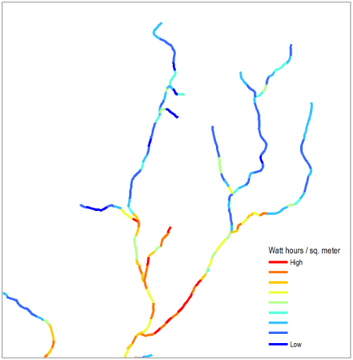
The Columbia Habitat Monitoring Program (CHaMP) protocol requires the collection of solar insolation data during stream surveys, however, collecting field-based solar insolation measurements comprehensively for the entire stream network of the Columbia Basin is resource prohibitive. Developing a spatially-explicit model to predict solar insolation for all stream networks and associated riparian buffers within the Columbia Basin will potentially provide a robust, reliable input for GPP modeling efforts, and may preclude the need for field-based data collection.
To date, our solar modeling efforts have relied on raster data derived from the National Biomass and Carbon Dataset (NBCD) basal area-weighted canopy height dataset. The NBCD was developed by the Woods Hole Research Center in 2000, and combines high-resolution inSAR data acquired by the 2000 Shuttle Radar Topography Mission (SRTM), US Forest Service Forest Inventory and Analysis (FIA) data, and remotely-sensed data from the Landsat ETM+ sensor. The tool then combines basal area-weighted canopy height values with bare-earth topographic values from a high-resolution digital elevation model (DEM), resulting in a relatively close approximation of stream shading, when calculating solar insolation using ESRI’sArea Solar Radiation tool. While we have obtained good results using NBCD basal area-weighted canopy height data, any vegetation height raster dataset (with elevation values in meters) will work as an input for the tool.
It is recommended that prior to using this tool, the required stream network input be segmented using the Geomorphic Network and Analysis Toolbox (GNAT) Segment Stream Network.
Citation
- Fisher, S. G. and G. E. Likens (1973). “Energy Flow in Bear Brook, New Hampshire: An Integrative Approach to Stream Ecosystem Metabolism.” Ecological monographs 43(4): 421-439.
- Hill, W. R., et al. (1995). “Light Limitation in a Stream Ecosystem: Responses by Primary Producers and Consumers.” Ecology 76(4): 1297-1309.
- Sinokrot, B. A. and H. G. Stefan (1993). “Stream temperature dynamics: Measurements and modeling.” Water Resources Research 29(7): 2299-2312.
Acknowledegments
The Solar Streams model and tool is actively developed and maintained by South Fork Research, Inc. (SFR). Funding for these tools was provided by the Bonneville Power Administration (BPA).
License
Licensed under the GNU General Public License Version 3.