matBRAT
matBRAT - Beaver Restoration Assessment Tool (Matlab based - version 1 to 2.03)

7. Formatting BRAT Input Data
Task 1: Export Final_NHD_Perennial_BRATInput.shp as a Text File
- Step 1: Open the attribute table of Final_NHD_Perennial_BRATInput.shp and export data.
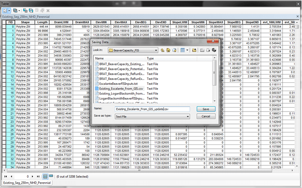
- Step 2: Export and save as a .csv file (Final_NHD_From_GIS.csv)
Task 2: Format the .csv Table
- Step 1: Open Final_NHD_From_GIS.csv in Excel
- Step 2: Make a column named Slope and make a formula to calculate channel slope (ElevMAX-ElevMIN)/Length for all entries.
- Step 3: If dam counts are not available, leave all cells for “e_DamCt” blank.
- Step 4: Previously, calculations to convert the DrainMAX column to square kilometers were required, but with the DEM to Flow Accumulation tool, this is no longer necessary.
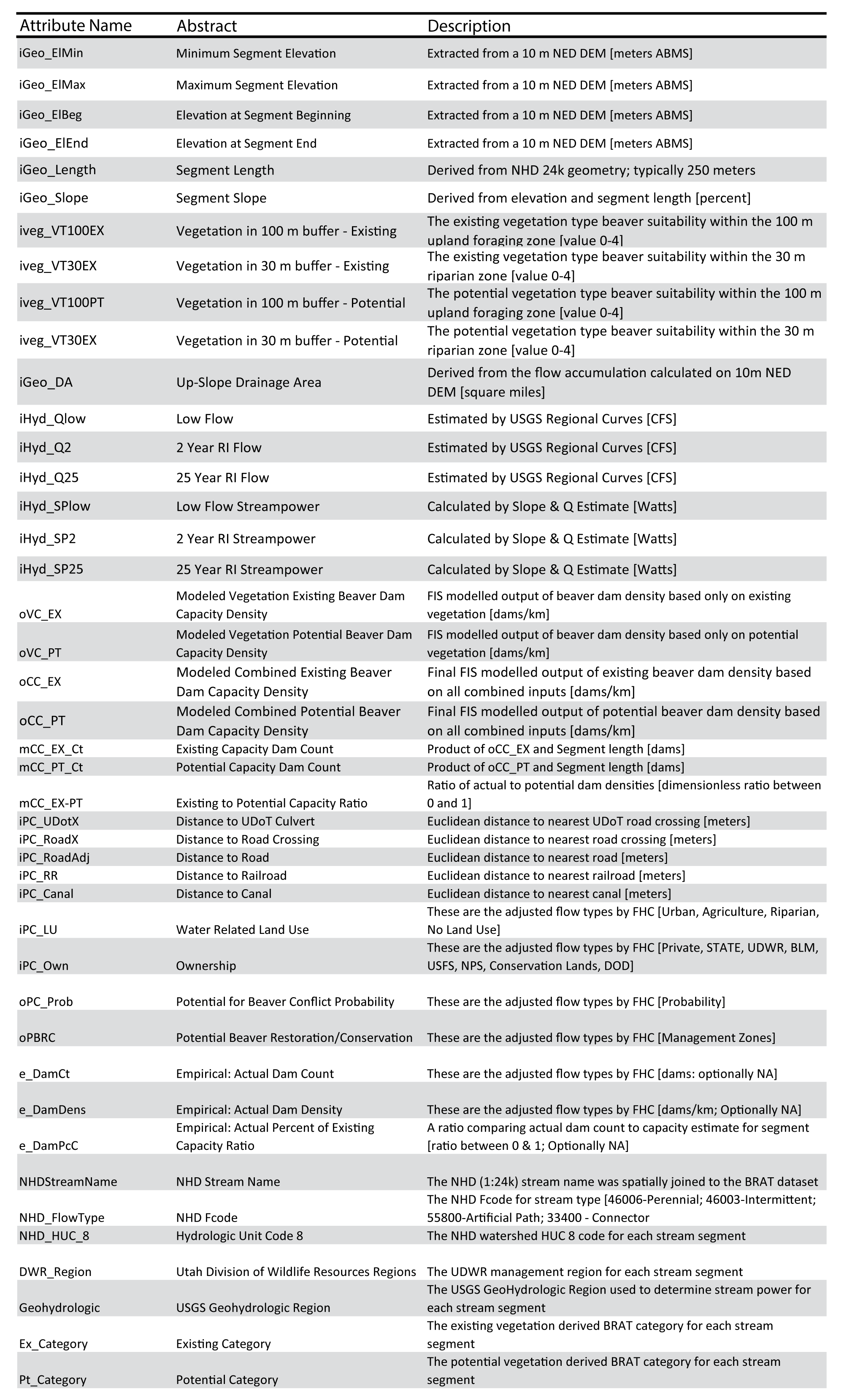
- Step 5: Format the table as follows for FIS input:
Format the table with columns A-S, as shown below:


-
Output (save as):
- Final_NHD_BRAT_Input.csv