matBRAT
matBRAT - Beaver Restoration Assessment Tool (Matlab based - version 1 to 2.03)

5. Potential Conflict Layer Processing
Task 1: Code Land Ownership Layer & Convert to Raster
- Step 1: Open the attribute table of your land ownership layer
- Step 2: Add a new field called ‘Code’
- Step 3: Assign each entry of the ‘Code’ field with a ownership value of 1, 2 or 3 based on the following lookup table.
Land Ownership Code Lookup Table
(1) Conservation Emphasis Land
Includes: Conservation Areas, Division of Natural Resources, National Park, National Historic Site,National Monument, National Wildlife Refuge/National Wildlife Reserve, Primitive Area, US Fish and Wildlife, Wilderness, Wildlife Management Area.
(2) Federal or State Land
Includes: Bureau of Indian Affairs/ Indian Reservation, BLM, BOR/Reclamation , County, State, State Sovereign Land, State Trust Land, US Forest Service, National Recreation Area, Parks and Recreation.
(3) Private land
- Step 4: Convert the Landownership shapefile to a raster using the “Polygon to Raster” command.
- Assign a 30 m pixel value
Task 2: Code Water Related Land Use Layer & Convert to Raster
- Step 1: Open the attribute table of the water related land use layer
- Step 2: Add a new field called ‘Code’
- Step 3: Assign each entry of the ‘Code’ field with a Land use value of 1, 2 or 3 based on the following lookup table.
Water Related Land Use Lookup Table
(1) Conversation Emphasis Land
Includes: Riparian, No Land Use, and Open Water
(2) Agricultural
Include: Irrigated, Non Irrigated, Naturally Irrigated
(3) Urban
-
Step 4: Convert the Land Use shapefile to a raster using the “Polygon to Raster” command.
-
- Assign a 30 m pixel value
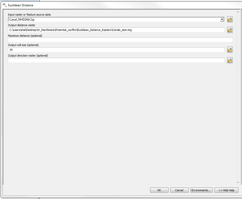
##Task 3: Generating Euclidean Distance Potential Conflict Rasters
- **Step 1: **Generate Euclidean Distance Rasters for each of your potential conflict layers (adjacent roads, railroads, culverts, stream/road crossings, and canals using “Euclidean Distance” (ArcToolbox under Spatial Analyst Tools -> Distance).
-
- Use an output cell size of 5 meters for adjacent roads (this smaller pixel value helps to better gauge potential conflict in areas where roads are within 30 meters of the stream center line).
- An output cell size of 30 meters is appropreate for the remaining conflict layers (railroads, culverts, stream crossings and canals).
- Assign an output grid name
- The example below uses canal data:
The output raster of canals should looks something like this (the UDWR Regions are shown for scale):
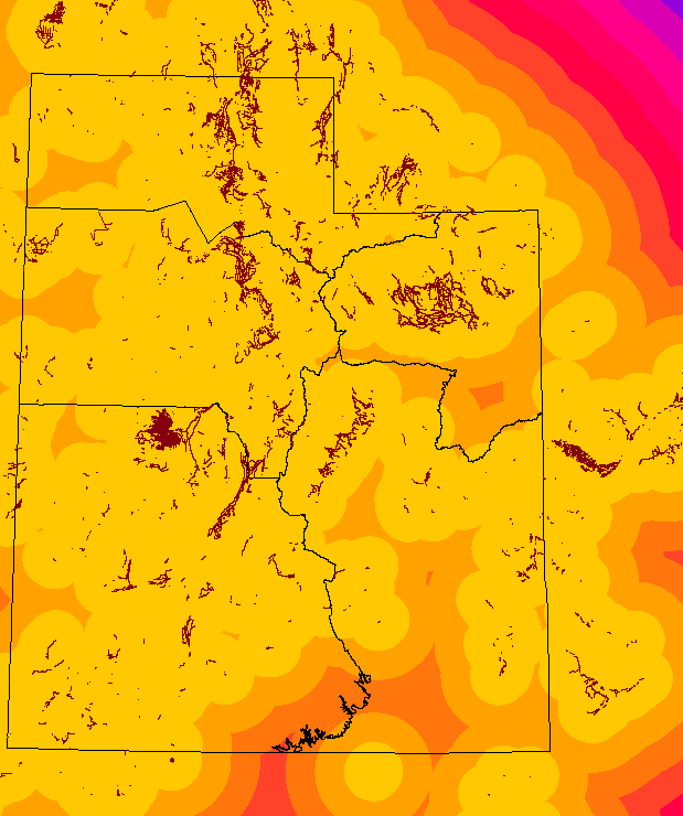
Remember to repeat this step for each of the potential conflict layers that you have captured.
<- Back to Step 4 Ahead to Step 6 ->