Assignment
See Corresponding Assignment
Module 9 - Mapping Floodplains Exercise
Background and why we're covering it
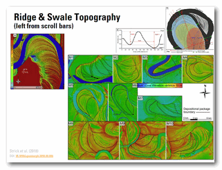
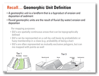
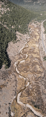 Floodplains make up the vast majority of most riverscapes and represent the largest temporary store of sediment. In this module, we focus on the primary processses by which floodplains are built and reworked, and how these leave characteristic geomorphic units. We will again reference the Wheaton et al. (2015) Fluvial Taxonomy for geomorphic units, which is an extension and recasting of geomorphic units as described in your book and the River Styles Framework.
Learning Outcomes
- LO 1. Confidently read any riverscape and be able to map its core characteristics.
- LO 6. Appreciate that topography is a quantitative record of landforms and apply morphometric analysis can be used to map and differentiate those landforms (i.e., geomorphic units).
- LO 7. Gain an appreciation of how geomorphic processes of erosion, deposition transport and storage of sediment shape topography and create, maintain, sculpt and destroy distinctive landforms.
Resources
Part 1 - Introduction to Floodplains
⏱️ 12 minutes.
Slides
Slides
Lecture Slides - Module 9 (Part 1)
Part 1 - Introduction to Floodplains
Part 2 - Floodplain Formation Processes
⏱️ 1 hour 4 minutes.
Slides
Slides
Lecture Slides - Module 9 (Part 2)
Floodplain Formation Processes
Part 3 - Floodplain Reworking Processes
⏱️ 51 minutes.
Slides
Slides
Lecture Slides - Module 9 (Part 3)
Floodplain Reworking Processes
Part 4 - Floodplain Geomorphic Units
⏱️ 33 minutes.
Slides
Slides
Lecture Slides - Module 9 (Part 4)
Floodplain Forms (Geomorphic Units)
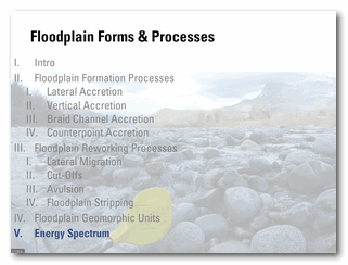
Part 5 - Energy Spectrum of Floodplains
⏱️ 6 minutes.
Slides
Slides
Lecture Slides - Module 9 (Part 5)
Energy Spectrum of Floodplains
Part 6 - Flooding of Floodplains - Not during floods?
⏱️ 13 minutes.
Slides
Slides
Lecture Slides - Module 9 (Part 6)
Flooding of Floodplains - Not during floods?
Related Reading
This module focus on: CHAPTER NINE: Floodplain forms and processes from:
- Fryirs KA, Brierley GA. 2013. Geomorphic Analysis of River Systems: An Approach to Reading the Landscape, First Edition. Blackwell Publishing Ltd.: Chichester, U.K.
Other Resources
Geomorphic Unit Toolkit
2015 Fluvial Taxonomy
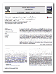 📄 Wheaton J, Fryirs K, Brierley GJ, Bangen SG, Bouwes N, O’Brien G. 2015. Geomorphic Mapping and Taxonomy of Fluvial Landforms. Geomorphology 248 : 273–295. DOI: 10.1016/j.geomorph.2015.07.010
Williams RD, Bangen S, Gillies E, Kramer N, Moir H, Wheaton J. 2020. Let the river erode! Enabling lateral migration increases geomorphic unit diversity. Science of The Total Environment : 136817. DOI: 10.1016/j.scitotenv.2020.136817
Examples of Floodplain Forms and Processes
Meander Migration
Why Rivers Curve
⏱️ 3 minutes.
Time Lapse on Variety of Rivers
⏱️ 1 minute.
Physcial Models
Meandering and braided river in the laboratory
⏱️ 24 seconds from Wout van Dijk
Morphodynamic Models (Numerical Simulations)
Modelling the evolution of large river floodplains
⏱️ 30 minutes from Andrew Nicholas (my modelling hero) presenting at 2014 CSDMS Meeting in 2014.
Modelling Floodplain Evolution
⏱️ 40 seconds from CHILD model at CU Boulder